World Maps
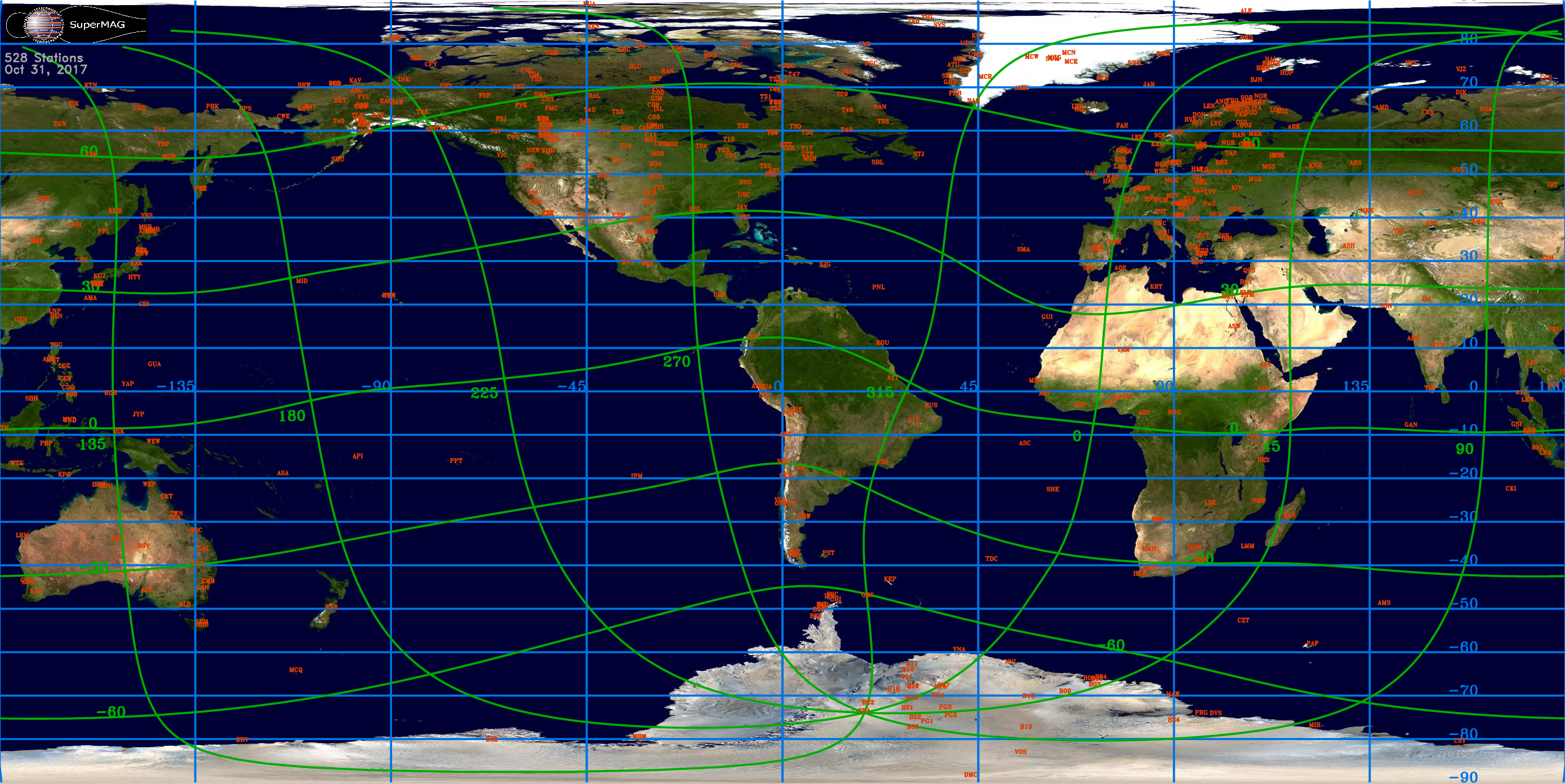
Geographic map (isotropic projection). Blue lines are geomagnetic coordinates while green lines are geographic coordinates. Stations are shown in red by their IAGA code. Click on image to download high resolution version:
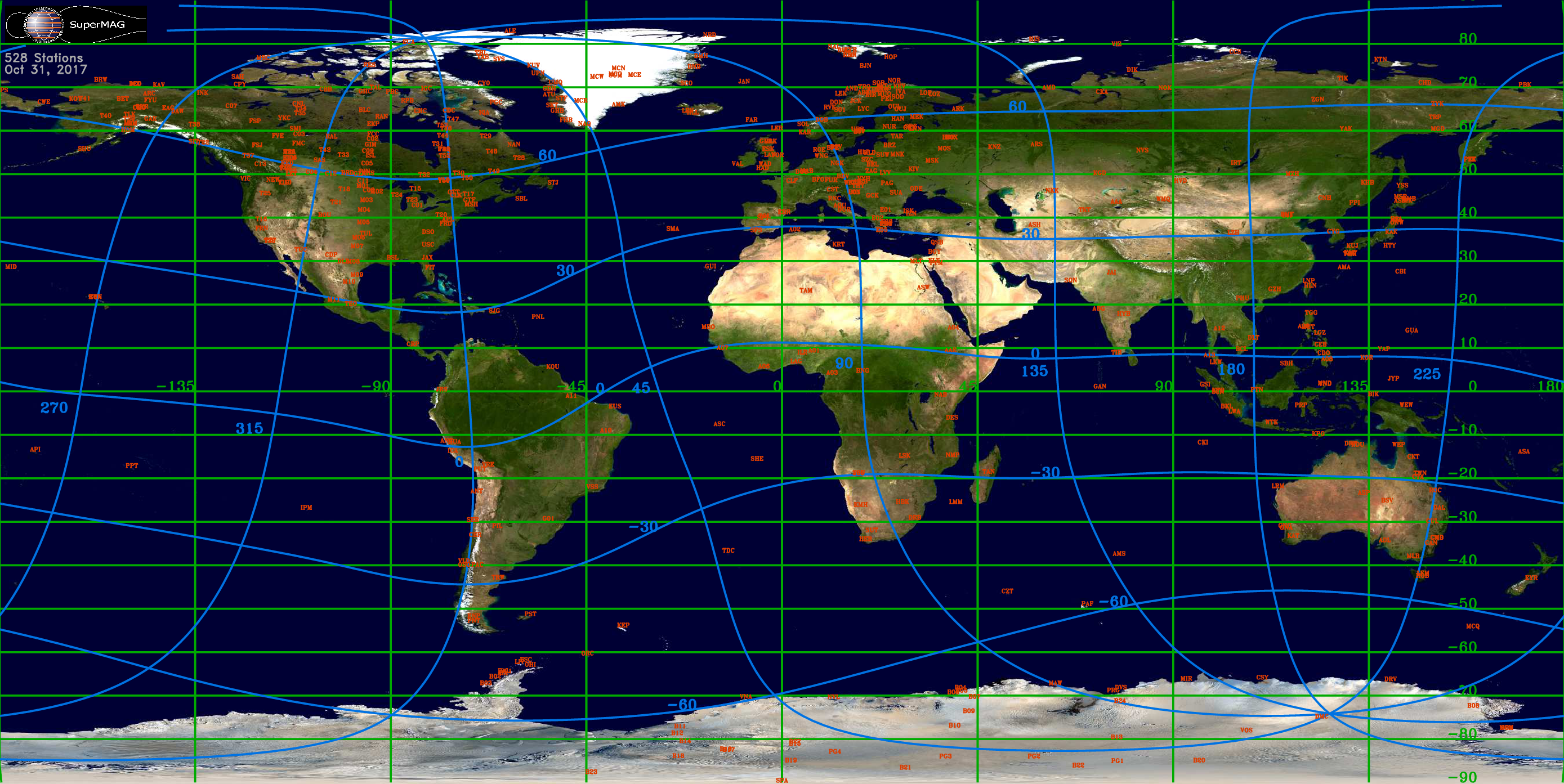
Geomagnetic map (isotropic projection). Blue lines are geomagnetic coordinates while green lines are geographic coordinates. Stations are shown in red by their IAGA code. Click on image to download high resolution version:
SuperMAG Logos
 |
Color, Black Background, 150DPI, PNG |
 |
Color, Black Background, 300DPI, PNG |
 |
Color, Black Background, 600DPI, PNG |
|
 |
Color, White Background, 150DPI, PNG |
 |
Color, White Background, 300DPI, PNG |
 |
Color, White Background, 600DPI, PNG |
|
 |
Black & White, White Background, 150DPI, PNG |
 |
Black & White, White Background, 300DPI, PNG |
 |
Black & White, White Background, 600DPI, PNG |
|
 |
Color, Black Background, Encapsulated PostScript |
 |
Color, White Background, Encapsulated PostScript |